Below are excerpts from the YRSMP. To read the full document, click on the link to download here: Yampa River Structures Master Plan
From the executive summary:
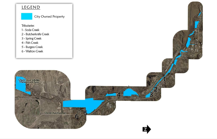
The Yampa River Structural Master Plan was created in a combined effort between Ecological Resource Consultants, Inc. (ERC), the City of Steamboat Springs (City) and the general public. It provides a framework for instream and riparian area improvements that will optimize the recreational benefits of the river while protecting its ecological integrity. The area that was used includes approximately 34,000 linear feet (6.4 miles) of the Yampa River located on City property from the Chuck Lewis Wildlife Management Area to the Fournier Open Space. The plan prioritizes the recommended improvements and provides budgetary cost estimates for City implementation. The study area consists of approximately 6.4 miles of river and riparian corridor located along City owned property.
Project area:
There are 6 main tributaries to the Yampa within the study area and include: Walton Creek, Fish Creek, Spring Creek, Soda Creek, Butcher Knife Creek and Burgess Creek. The land adjacent to the River is held in both public and private ownership and there is development, existing or planned, on many of the river’s borders within the study area. City owned properties were analyzed as part of this Plan. Some other adjacent areas that were identified as areas of interest by the City that are not on City property were also evaluated.
Community Amenity:
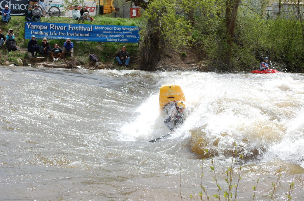
The Yampa River corridor is one of the most important amenities to the City of Steamboat Springs. From its value as an ecological resource to its economic impact on the community from activities associated with stream related recreation to the beauty and character it provides, the Yampa corridor is vital to the City. The community appreciates how important a resource it is and has worked hard to protect and improve the area. Use of the corridor by the public is encouraged by the multitude of parks and trails that the City has developed. Parks located along the River include: Dr. Rich Weiss Park, River Creek Park, Rotary Park, Fetcher Park, Emerald Park, Little Toots Park, WestLincoln Park, Howelsen Park and the Stockbridge Multi-Modal Center. Wildlife Management Areas (WMAs) like the Chuck Lewis WMA and public open space also exist along the River. Connecting the parks and neighborhood trails is the Yampa River Core Trail. This trail follows the river from Walton Creek Road and Highway 40 to the James Brown Bridge on Shield Drive and provides access to the river. The trail is highly used and there are plans to extend the trail South and West along the river corridor.
Master Plan Improvements:
The City’s stated objectives for this project were to define master plan improvements:
- To enhance/preserve the natural character of the River through river rehabilitation improvements.
- To enhance the value of the River as a community amenity through access points and recreational use opportunities.
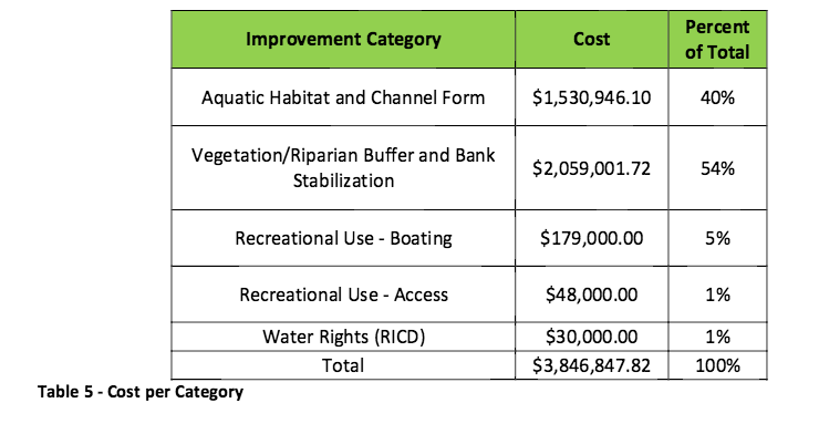
A. River Rehabilitation Improvements:
- Bank Stabilization
- Vegetation and riparian buffer
- Channel Form
- Aquatic Habitat
B. Recreational Use Improvements:
- Access
- Boating
- Water Rights Improvements