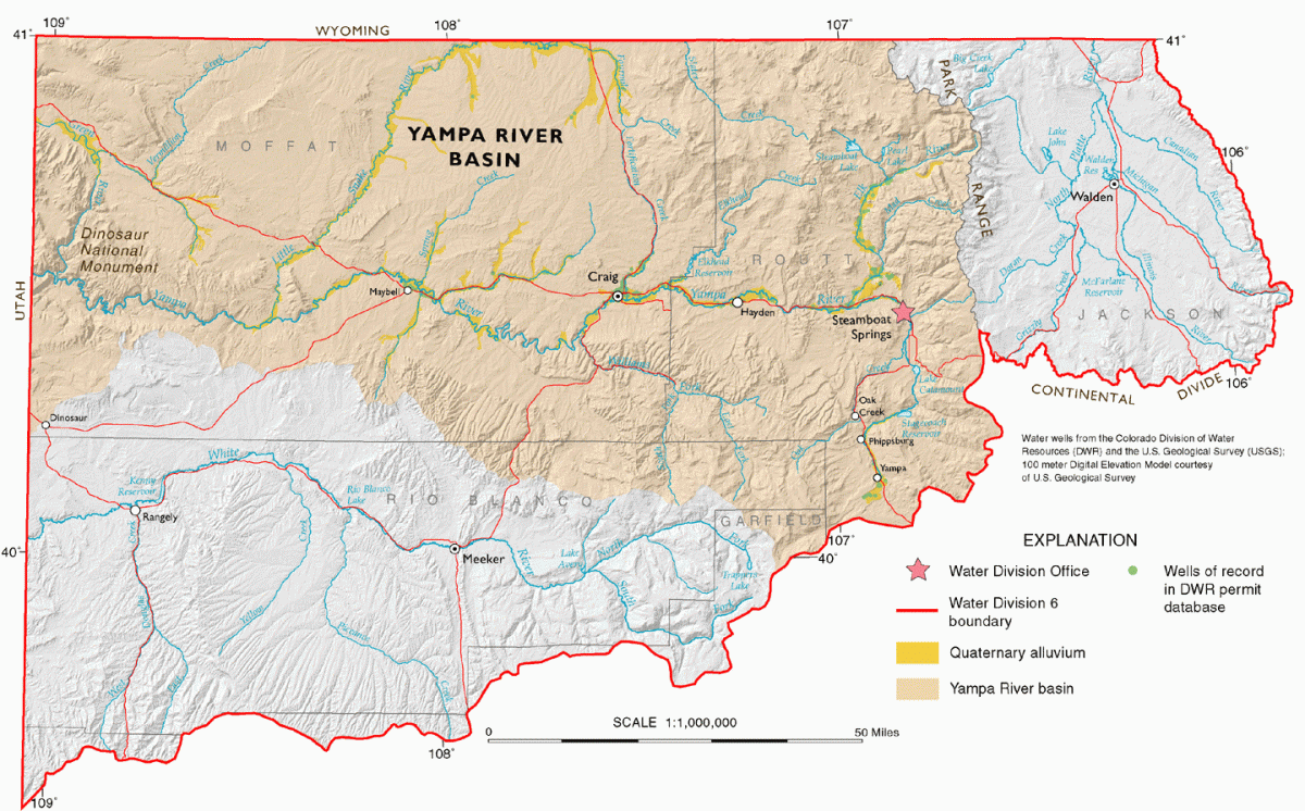
Yampa River Statistics, Facts and Maps
Introduction to the Basin
The unregulated, wild, and free Yampa River starts at its headwaters in the Flat Tops Wilderness Southwest of Steamboat Springs, CO. The Flat Tops are well known for the Devil’s Causeway, which is a fantastic hike over a narrow land bridge at 11,800 feet in elevation. The Yampa River originates in the Flat Tops at a spring fed creek and then flows into the Bear River and on its way past a diverse landscape where ranchers, boaters, fishermen, and mountain dwellers alike have a connection to the 250 mile stretch of river.
The Yampa River serves as the lifeblood for Northwest Colorado in many ways. This river, due to its limited reservoir storage, still retains a natural hydro-graph that sees very high peaks and low base flows. This dynamic flow regime still floods its banks on big snow years, connecting the river to the cottonwood, red-osier dogwood and box elder tree communities that are endangered in other, more developed river systems. Due to the mostly unrestricted flows in the Yampa River, there are also endangered fish that are now forever gone from other Western rivers.
River-based recreation is a big part of the western lifestyle that the Yampa holds true. Fishing, rafting, kayaking, bird watching, hiking, exploring and other fun-filled and active recreation types are a paramount use of this river. Estimated recreational visits alone range to as high as .5 million a year. Beyond the non-consumptive uses of the Yampa River, there are other consumptive uses like agriculture, municipal and industrial uses of the Yampa that make this river a very important system.
Background
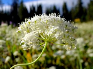
The name ‘Yampa’ is a Native American name for a white flowering, parsley-like plant, Periderrida gairdneri. It can be simplified to “water plant” or “common plant.” The roots were eaten by the Snake people or the Bannock, Shoshone, and the White River Ute tribes which were comprised of the Yamparika Utes. They had settled in that area around 1500 A.D and utilized the river for water and hunting in the valley. The word “yampa” has mistakenly been interpreted to mean “bear” and can explain the Yampa’s early years of being called the Bear River. Human presence in the basin can be traced back to 7000 BC.
The plant was found throughout the watershed and first evidence of the recorded name ‘Yampah’ was found in John C. Fremont’s journal entry from 1843. Fremont an explorer, politician, and soldier, led 5 expeditions in the American West during the 1840s.
Ferdinand Hayden first began to map and investigate the land with sponsorship from the U.S government. By 1877 his survey, with the course of the Yampa River plotted out, appeared in the first Atlas of Colorado. John Wesley Powell mapped the last four miles of the Yampa from his explorations of the Green and Colorado Rivers, eventually leading him to complete two descents down the Grand Canyon on The Colorado. The first homesteaders moved into the Yampa River drainage after the forcible removal of the Utes, bringing with them cattle grazing, established senior water rights, and the city of Steamboat Springs in 1885. More than 70% of the water diversion from the Yampa today goes to agriculture.
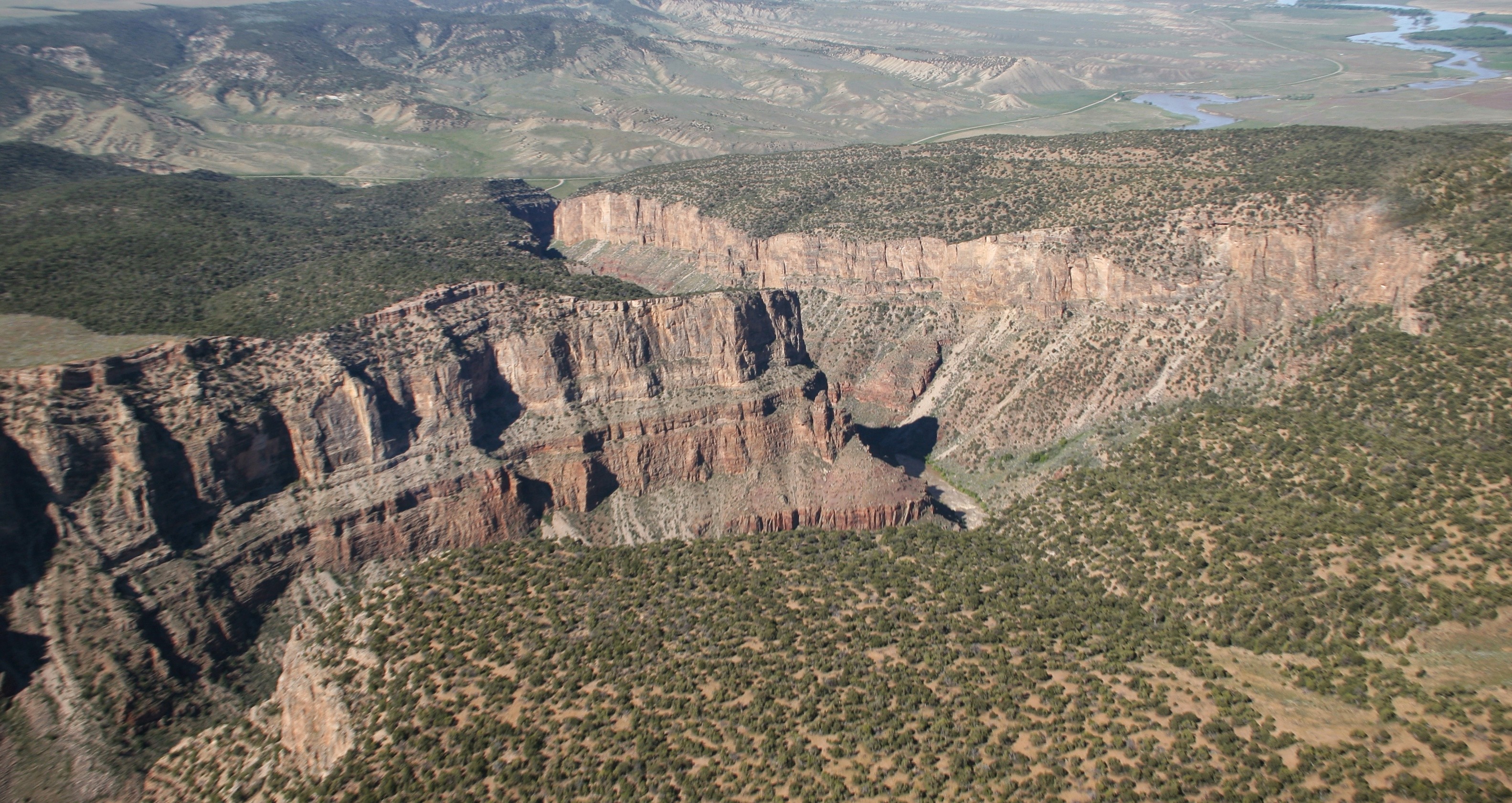
Along the canyons of the Yampa River one can observe the Uinta Mountain Group Formation; metamorphosed sand, mudstones, and fossils about 650 million years old. There are also sedimentary rocks ranging back to 280 million years of age and igneous rocks, originating from molten rock and lava, including limestone and sandstone. Some river sections where you can view such formations include:
The Yampa Canyon, Dinosaur– Sedimentary
The Yampa Monocline, entering Yampa canyon– Monocline, up warped and flattened sedimentary rock
Tow Creek, East Hayden– Fault, vertical break in the crust
Cross Mountain– anticline
Middle and Upper sections of the canyon– igneous
Remains of volcanoes can be seen throughout such ranges as well, including Rabbit Ears Peak and the Flat Tops Wilderness Area. The river carved these amazing canyons, and through high spring flooding, land rising, downcutting erosion, and millions of years they were formed to be what we see here today.
The River’s Tributaries, Flows and Watershed Size
Tributaries
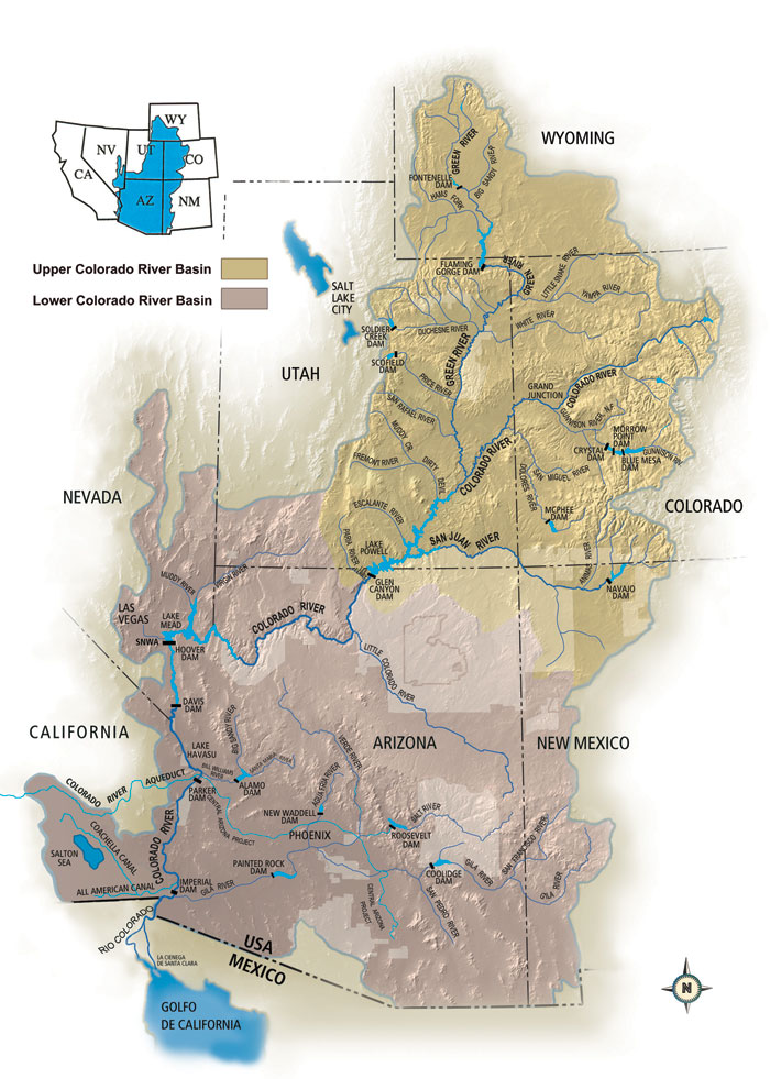
This Upper Colorado River Basin river gains water from many other streams, creeks, and rivers including its larger tributaries, from left to right: the Bear River, the Williams Fork, Elk River, and the Little Snake River. The most distant tributary is the Bear River and where it meets Phillips Creek near the town of Yampa is where the river is officially named, the Yampa River.
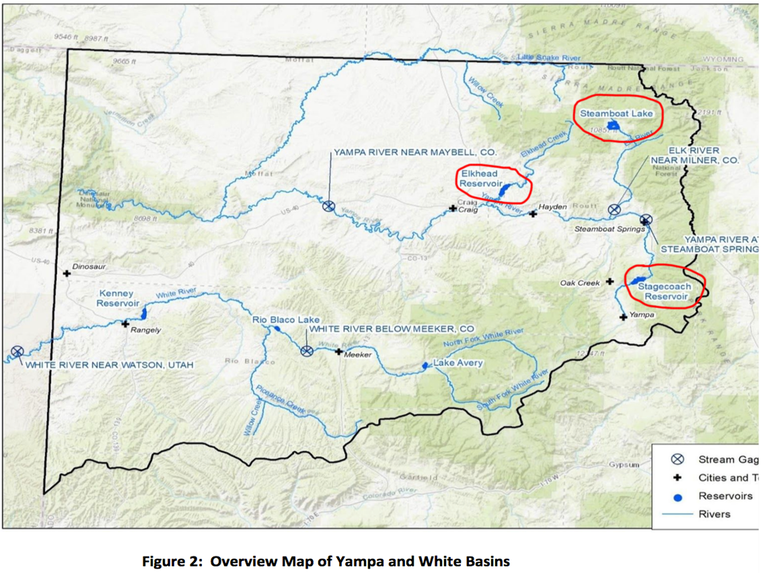
Now past the town of Phippsburg and past Stagecoach Reservoir and Lake Catamount (see Reservoirs below), the Yampa begins to double in size as it enters the city of Steamboat Springs. It gains water here from its tributaries named Walton, Burgess, Fish, Butcherknife, Spring, and Soda Creeks. Past the city, the Yampa again doubles in size with help from the northern Elk River. Around Craig, the Williams Fork and Elkhead River also increase the river’s volume and it then passes the towns of Hayden and Milner, officially moving from the Park Range to the arid and widespread sagebrush county of Moffat.
Past Little Yampa Canyon and Cross Mountain Canyon (1,000 ft. gap of high water carved by the river), the Little Snake River gives the last of the additional flows (and substantial sediment) to the river.
After the Little Snake River, the river flows through the slick-rock canyon of Yampa in Dinosaur National Monument. Close to the Utah state line and the heart of the monument, the Yampa River reaches its end at one of the most magical of places, the confluence with the Green River at Echo Park.
The Green River is the largest tributary of the Colorado River. The Yampa provides about one-third of Colorado’s contribution to the Colorado River.
Flows and Watershed Size
We can examine the seasonal flow patterns of the rivers in the west thanks to hydrographs. Flows are measured in water volume or in cubic feet per second (CFS). After the snow has covered the Rocky Mountains, spring and summer runoff fills the river, bringing it up to as high as it’s peak flow at Deer Lodge park between 1982 and 2013: 13,600 cfs.
The Great Divide basin borders the Yampa River to the north and the White River borders it to the south. Also running west into the Colorado and to the north and east sides of the basin runs the Continental Divide. It is separated from the North Platte River which eventually flows into the Mississippi River system to the east.
- Current Flows
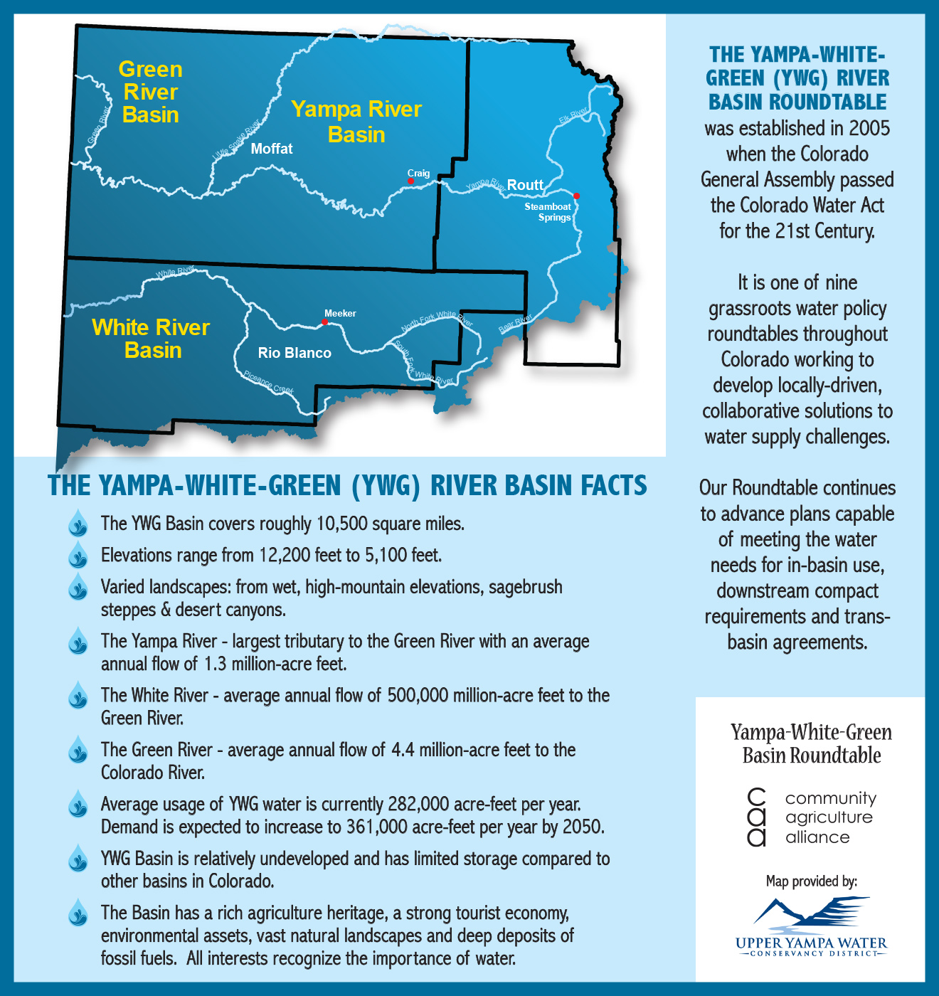
- The whole basin including the White, Green, and Yampa Rivers is a total of 10,500 square miles
- The Yampa River is approximately 250 miles in length with the lower 46 miles flowing through Dinosaur National Monument
- The elevation in the basin ranges from 12,200 feet at Mount Zirkel in the Park Range, to about 5,100 feet at the confluence in Echo Park
- The highest average peak month is May with 8,200 cfs
- The lowest is seen between August and October with 342 cfs.
- The Yampa River is the largest tributary to the Green River with mean annual flow of 1.3 million acre-feet (MAF) in a broad range of 0.5 – 2.3 MAF
- That consists of 15% of the total streamflow that leaves Colorado
- Drought and changing climate patterns greatly impact the water supply in the river.
- Craig Press: A dry, dry year: The future of the Yampa river basin
- Steamboat Pilot: Warm, dry year breaks records in the Yampa River Basin
- Mountain Town News: A first-ever ‘call’ on the Yampa River as the climate veers warmer
- Craig Press: Northwest Colorado water users wary of potential water cutbacks by state
Water Usage
About 3,000 acre-feet of groundwater is withdrawn annually from the basin and about one-third of this water is used for irrigation purposes. The basin’s alluvial groundwater resources are mainly used for livestock, domestic, and lower demand commercial purposes. Most of these alluvial wells are located around the towns of Steamboat Springs, Phippsburg, Hayden, and Yampa, and used for their public water supply.
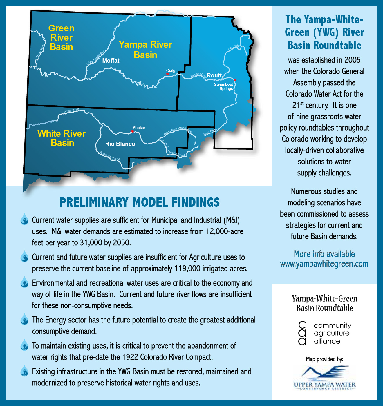
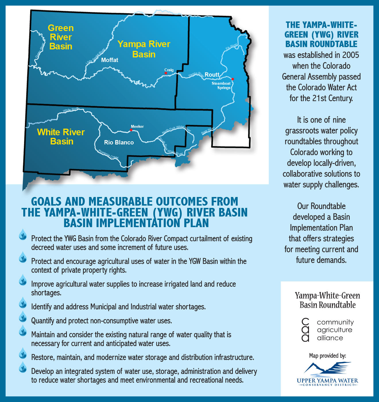
The Yampa-White-Green River Basin Roundtable is part of nine regional roundtables made up of local stakeholders and citizens in order to identify issues and solutions related to water. This is largely due in part to drought, use controversies, and water availability in the West.
Their Basin Implementation Plan sums up the main facts and challenges that the basin is currently facing around water supply.
For more on the Colorado Basin water supply visit:
Reservoirs
The Yampa River does have some reservoirs in the basin and some of these are on the main stem of the river. Elkhead, Steamboat Lake, Catamount, and Stagecoach are small-scale reservoirs that do not impede the Yampa’s peak flows that are critical to keeping this river wild.
The Yampa River would have been affected by a proposed dam site in the 1960s, slated to appear in Echo Park. Luckily it was saved by the efforts from environmental groups such as The Sierra Club and the executive director at the time, David Brower. Unfortunately, it led to a compromise that allowed the Glen Canyon Dam (The Colorado) and Flaming Gorge Dam (The Green) projects to be pursued.
Despite these reservoirs, the Yampa remains one of the only rivers in the state of Colorado to function as a wild and “free-flowing” system.
Slides/Past Presentations
Kevin McBride’s presentation from the 2017 State of the Yampa event, courtesy of the Upper Yampa Water Conservancy District:
Interesting Colorado water usage facts from a presentation by Wayne Vanderschuere, former General Manager of the Water Services Division of Colorado Springs Utilities. (Note: some of this information is dated, but we think you’ll find many of the facts and figures interesting and still relevant today.)
