

Yampa River Stewardship Program
The Yampa River Stewardship Program (YStew for short) is a planning and capacity building program led by Friends of the Yampa and supported by the Yampa River Collaborative. Using river health data and stakeholder input, YStew identifies specific ways to move the Yampa to a healthier state through empowering landowners, land managers, and practitioners to implement river restoration projects and land management practices that support river health.
Specifically, YStew does this by: 1) Engaging stakeholders to define desired future conditions and develop strategies to move existing conditions toward this vision, 2) Identifying common barriers to implementing river restoration projects and land management practices, and 3) Providing landowners, land managers, and practitioners with training on how to use the identified strategies, resources, and support to reduce barriers to project implementation.
The overall intent of YStew is to bridge the gap from the planning work that has been conducted in the Yampa basin for years to on-the-ground implementation of projects.
Existing Conditions
Desired Future Conditions
Strategies
Resources & Training
Why Is It Needed?
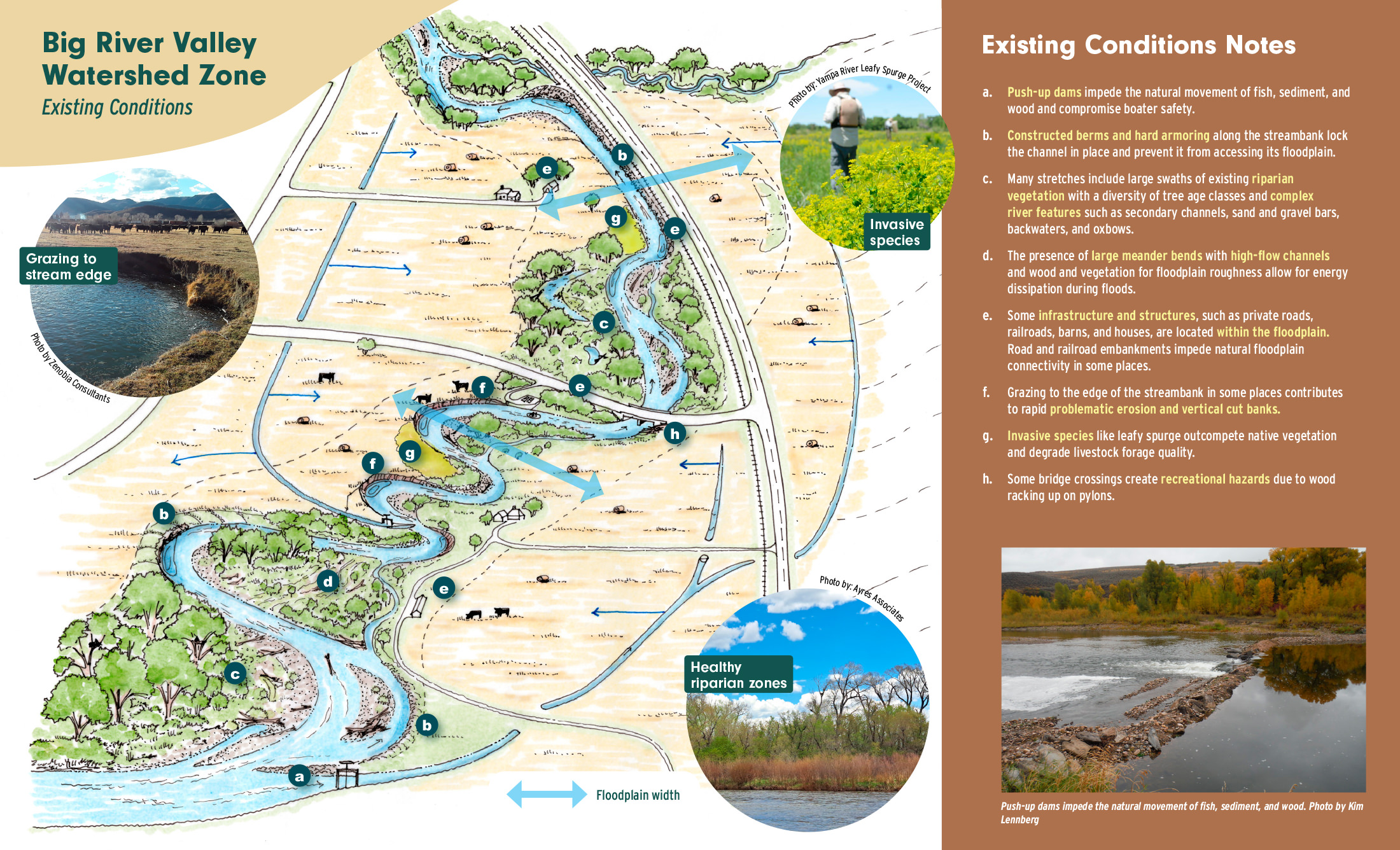
YStew was identified as a recommendation in the Integrated Water Management Plan, the culmination of a multi-year stakeholder-led planning process finalized in 2022. Meant to work in tandem with the Yampa River Scorecard Project – a longterm river health assessment project – YStew uses the Scorecard’s data on existing river conditions as a basis for determining desired future conditions and strategies and resources for achieving those conditions.
By strategically identifying and prioritizing river health projects, determining how these projects should be completed, and building capacity in landowners, land managers, and practitioners to implement those projects, we can improve the health of the Yampa in a way that is stakeholder-driven, science-based, and on a watershed-scale.
Desired Future Conditions
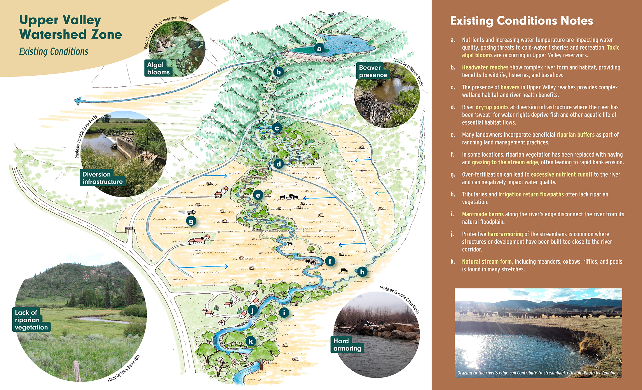
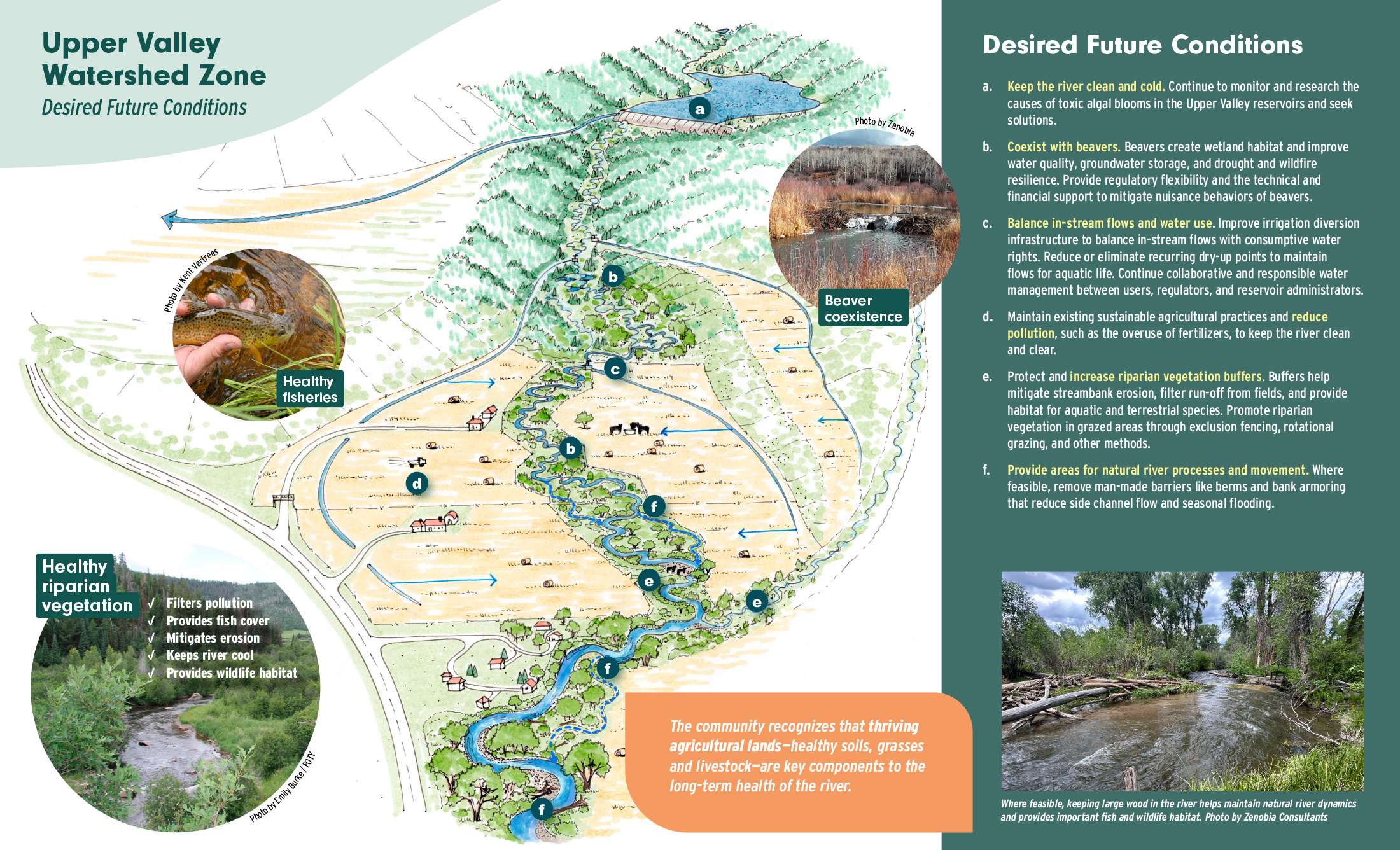
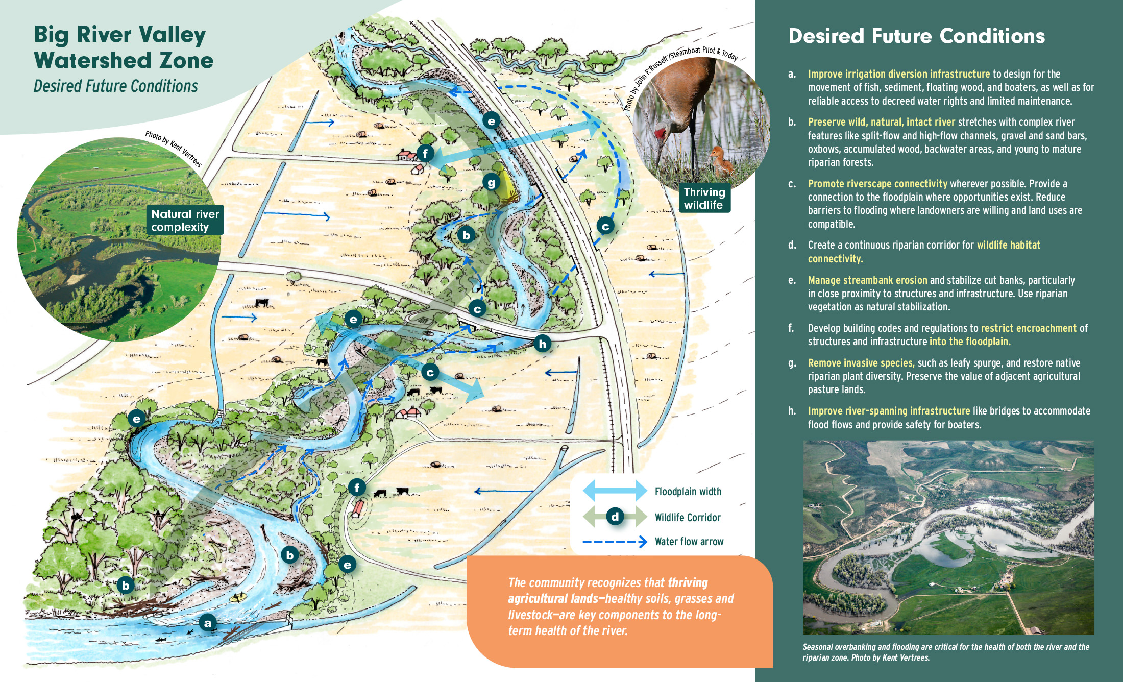
YStew has divided the river into different watershed zones, each of which reflects the unique characteristics of multiple sections of the actual river: the Upper Valley, the Town Segment, and the Big River Valley. Existing conditions were determined through a review of data from the Scorecard project and other available data, leading to illustrations of representative scenes for each watershed zone that serve as important tools during conversations about desired future conditions. Illustrations that showcase the desired future conditions identified throughout workshops and one-one-one outreach to stakeholders were then developed for each watershed zone.
Upper Valley
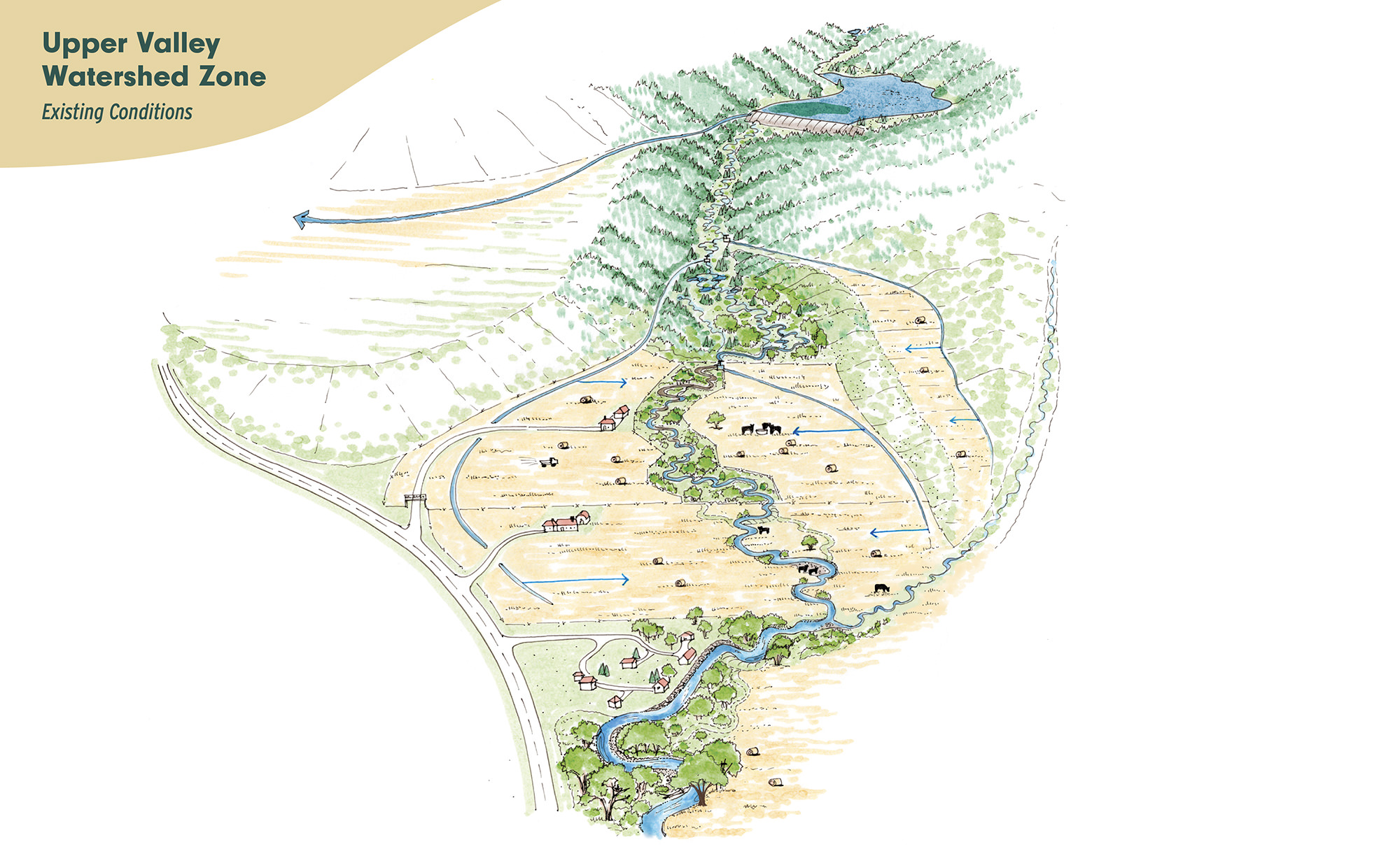
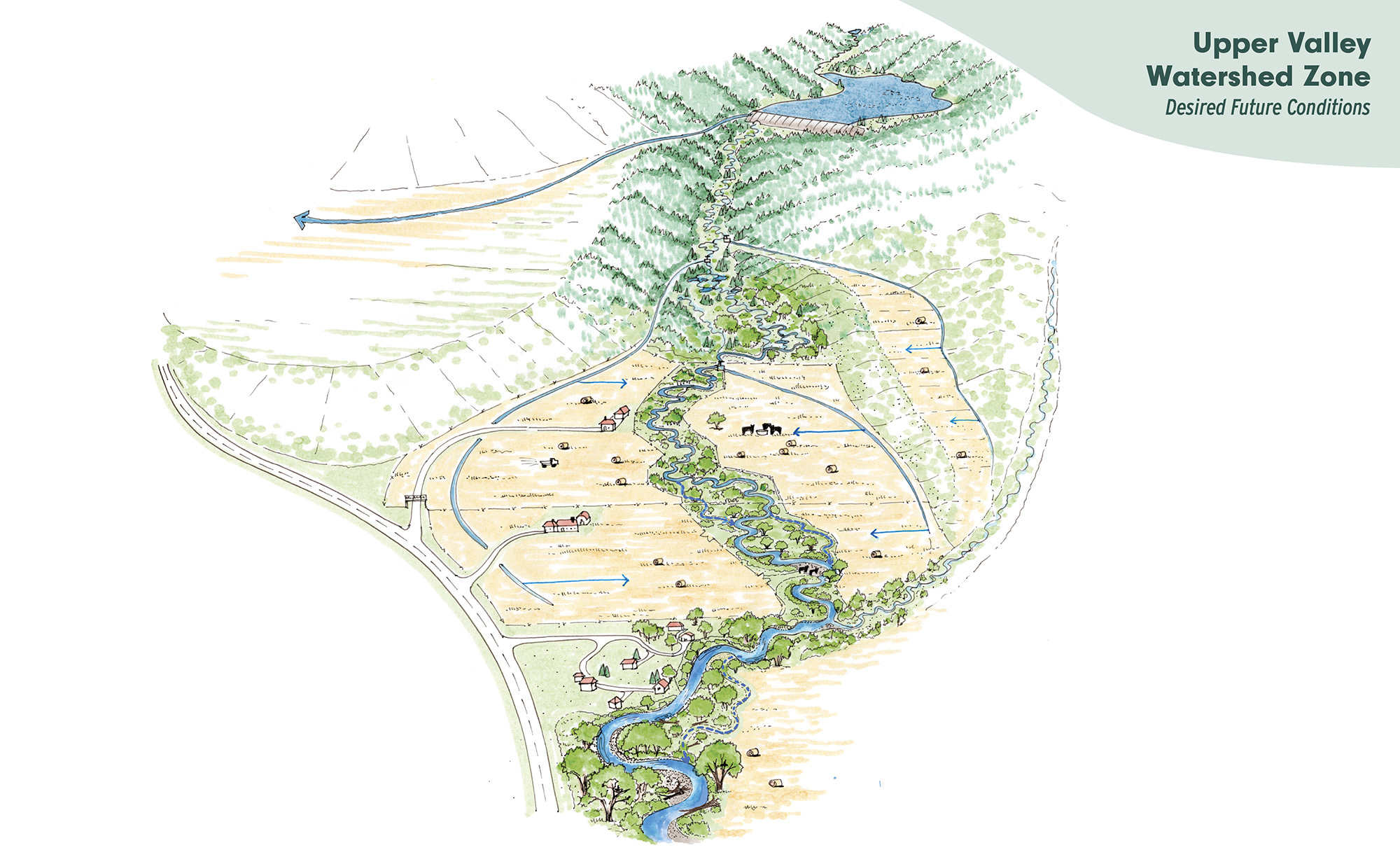
The Upper Valley zone is characterized by streams descending from the headwaters to relatively narrow agricultural valleys. In this zone, desired future conditions include:
- increasing streamside (riparian) vegetation to provide habitat and stabilize streambanks
- eliminating dry-up points to maintain river baseflows throughout the year
- balancing natural processes like flooding and channel migration with land use
- determining the causes of and mitigating toxic algal blooms in reservoirs
Click the images to learn more about the existing and desired future conditions in this zone.
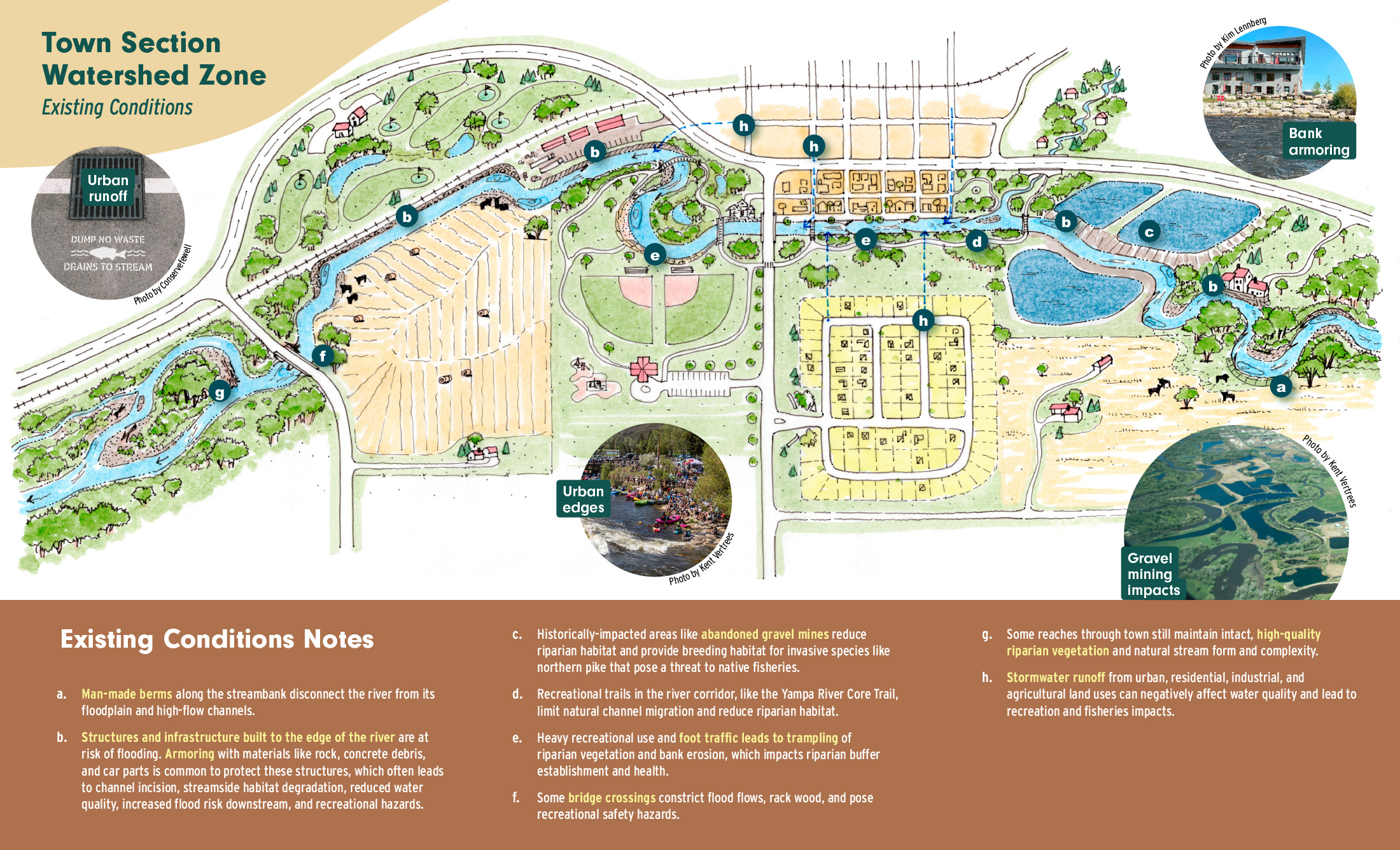
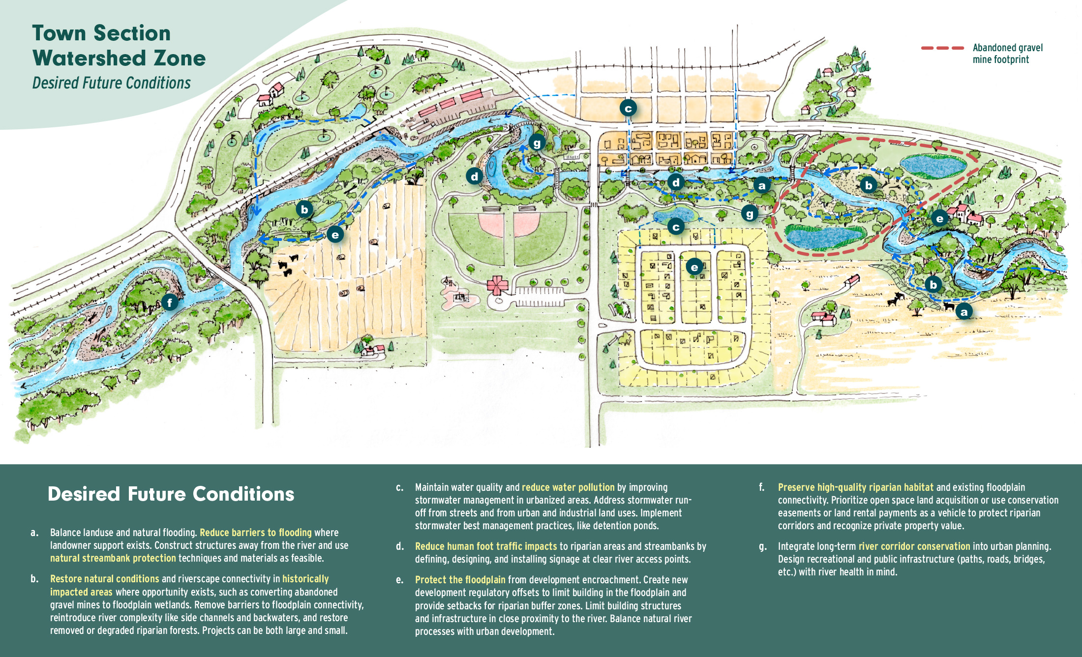
Town Segment
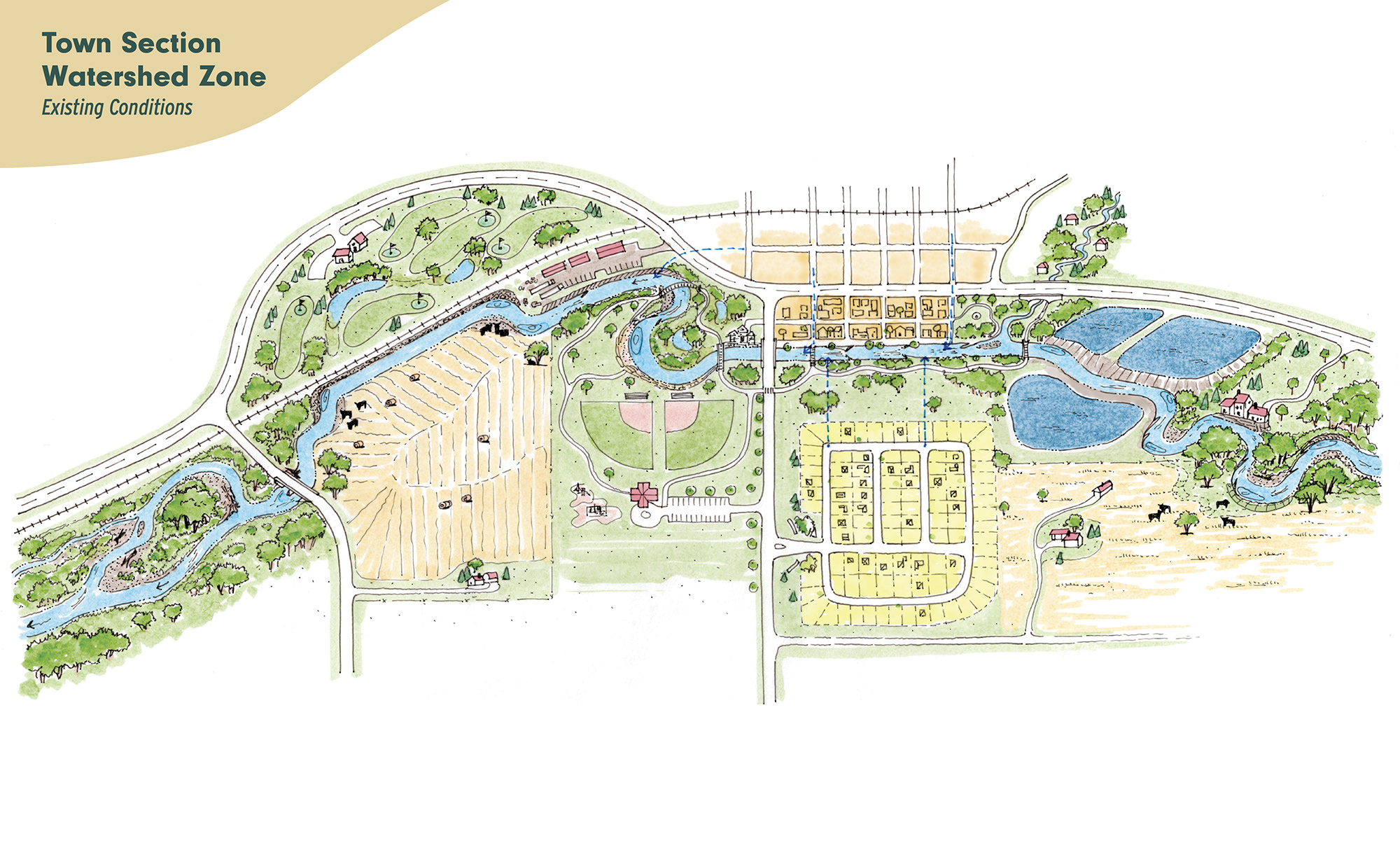
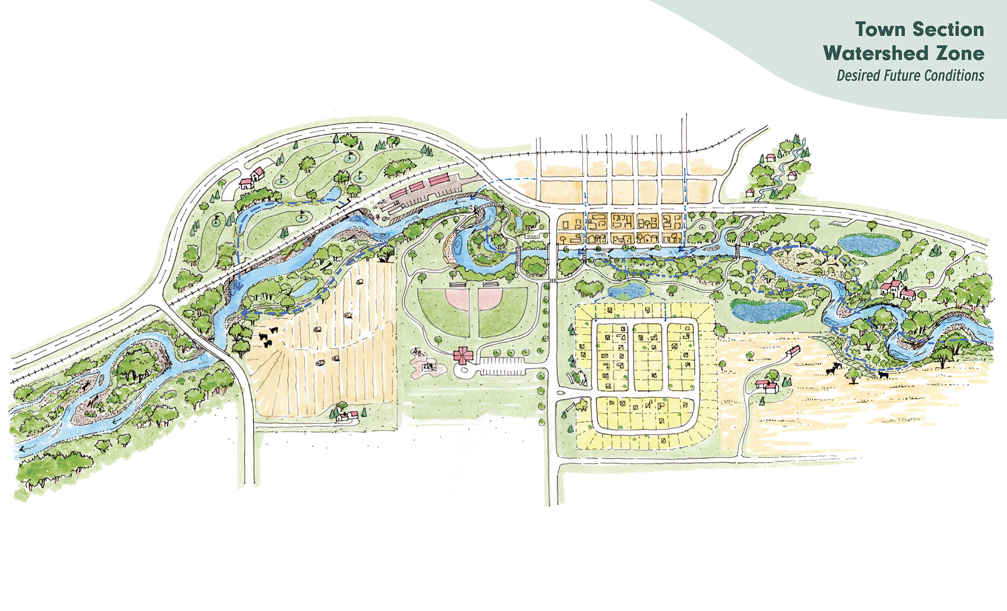
The Town Segment zone occurs wherever the river interfaces with urban and exurban land uses like residential, commercial, and industrial development. In this zone, desired future conditions include:
- improving water quality, with a focus on improved stormwater management and decreased river temperatures
- restoring of historically impacted areas like gravel mines and other development
- preserving the pockets of high-quality riparian areas that still exist
- reducing human foot traffic impacts to streambanks by designing clear river access points
Click the images to learn more about the existing and desired future conditions in this zone.
Big River Valley
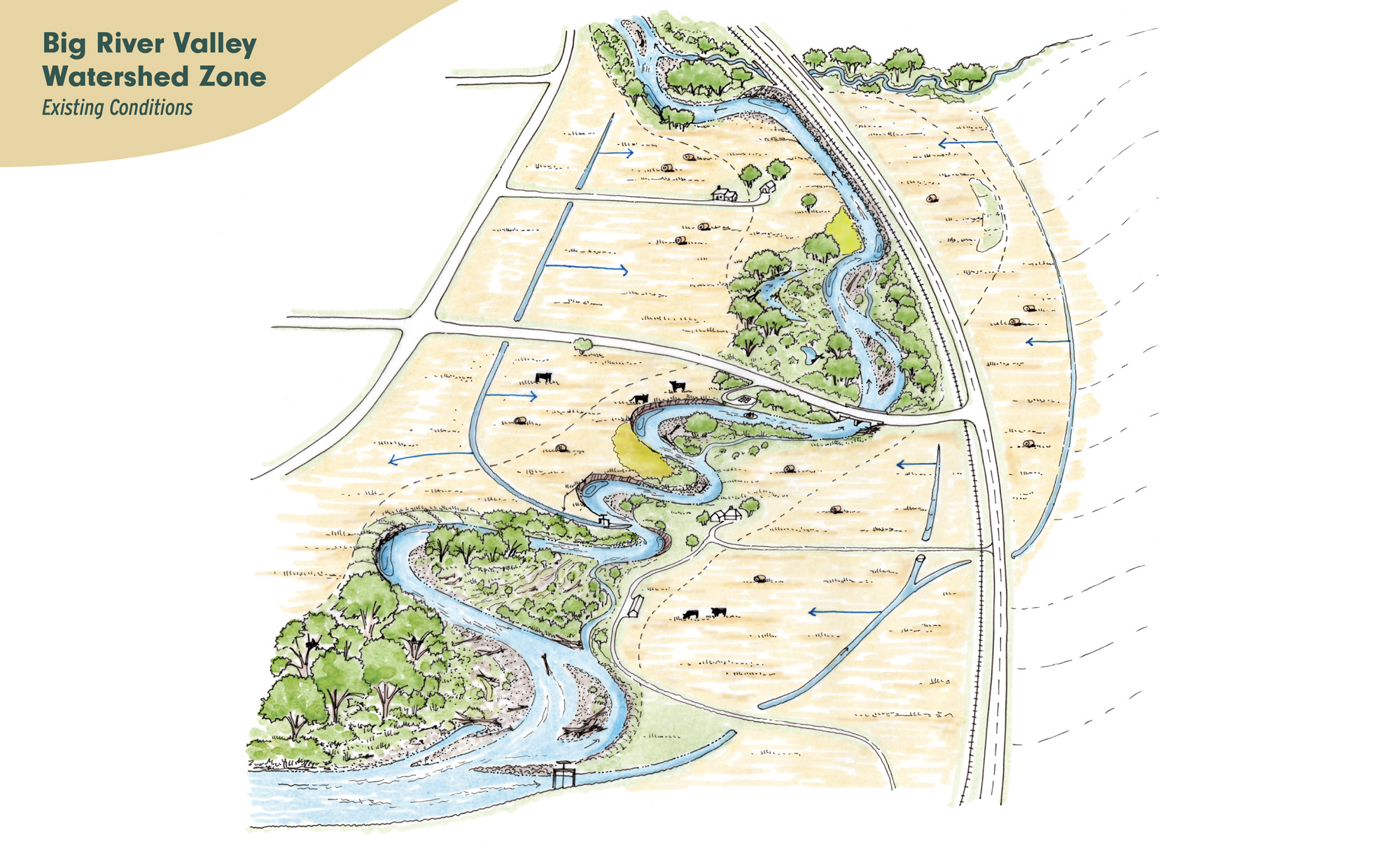
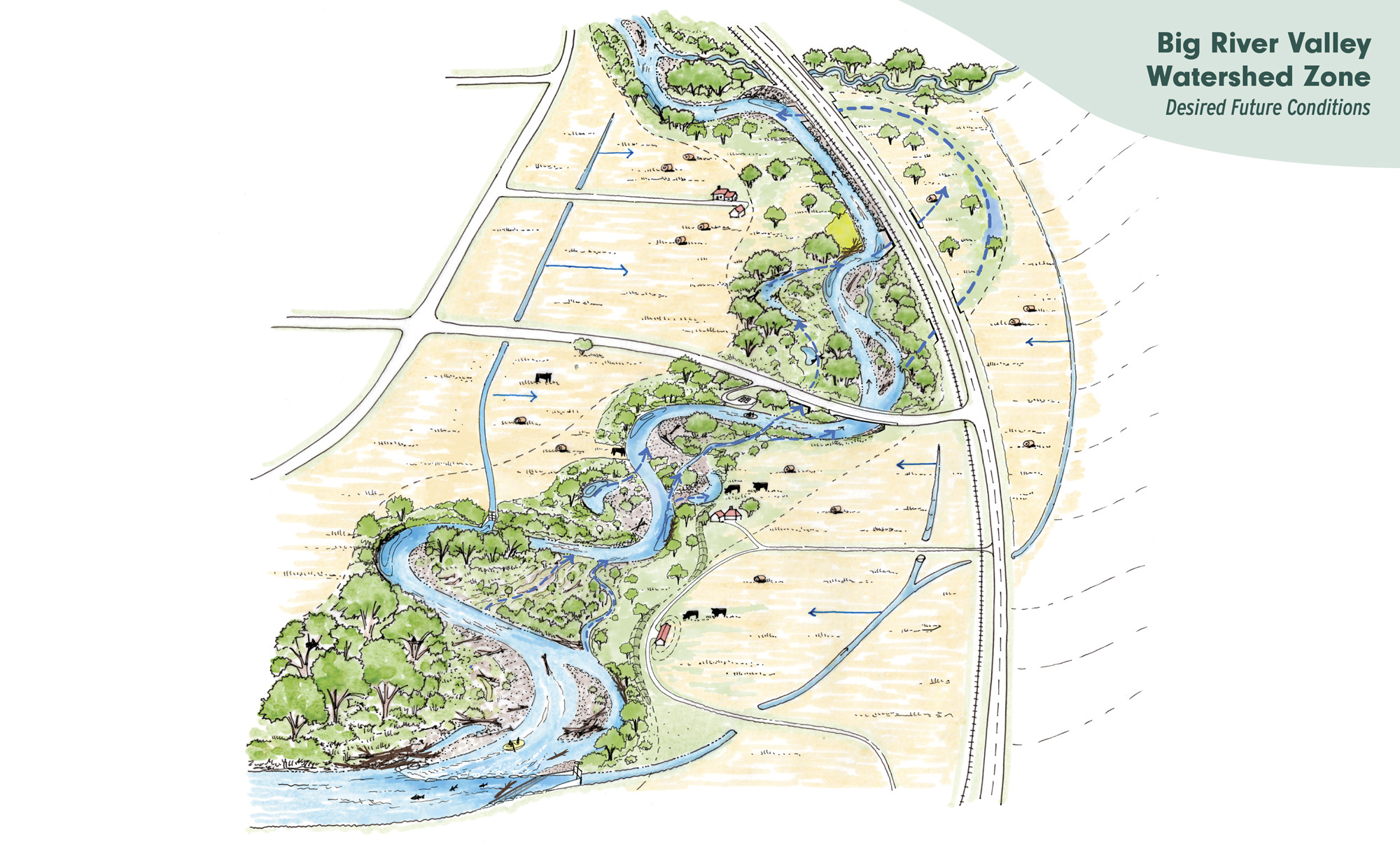
The Big River Valley is characterized by a relatively large volume of water running
through a wide agricultural valley. In this zone, desired future conditions include:
through a wide agricultural valley. In this zone, desired future conditions include:
- conserving riparian forests and wetlands to create a connected wildlife corridor
- modernizing irrigation infrastructure for multi-benefits to producers, river health, and fish
- allowing natural river processes like flooding and channel migration to occur where landowners are willing and land uses are compatible
- preserving this zone’s existing natural riverbed and streambank complexity
Click the images to learn more about the existing and desired future conditions in this zone.
Strategies & Resources
YStew identifies specific strategies to help landowners, land managers, and practitioners deal with the challenges of owning, managing, or working on lands along a wild and dynamic river. These strategies are still under development but will be compiled in a user-friendly guidance document once finalized.
For now, click on the buttons below for printable brochures for each river segment.
Photo Courtesy of Peter Williams
Thank you to our partners
Funders
Partners
Yampa River Collaborative
Join Our Mailing List
To stay up to date on YStew and opportunities to get involved, sign up for our mailing list
Project Sign-Up Form
If you have an idea for a project on land you own or manage along the Yampa River or a major tributary, please fill out this project form and we’ll be in touch with next steps. For questions, please reach out to Emily Burke at emily@friendsoftheyampa.com